


Abuja, 18–19 November 2026
1. The Niger Basin Authority (NBA), in collaboration with the Federal Ministry of Water Resources and Sanitation and the National Focal Structure (NFS) of Nigeria, held a validation workshop on the diagnostic study of flood and low-water early warning systems (EWS) in Lokoja (Kogi State) and Yola (Adamawa State) at the Stratton Hotel, Asokoro, Abuja, on 18 and 19 November 2026. The workshop was supported by German Development Cooperation through the “Support to the Niger Basin Authority” project, implemented by GIZ on behalf of the German Federal Ministry for Economic Cooperation and Development (BMZ).
Participation
2. The workshop brought together 50 participants from: the federal ministries responsible for water resources, environment, agriculture and finance; NEMA, NIHSA, NiMet, NASRDA, NWRI and NIWA; Adamawa and Kogi States (offices of the Honourable Commissioners, State Emergency Management Agencies-SEMAs-and Ministries of Local Government); the Upper Benue and Lower Niger River Basin Development Authorities; the NBA Executive Secretariat and the Niger Basin Observatory; GIZ; and LINS Consult Ltd, the firm that carried out the study.
Opening Ceremony
3. The opening ceremony began with the national anthem, followed by welcome remarks from Engr. Ibrahim Magaji on behalf of the NFS of Nigeria. Mr Bachir Alkali Tanimoun delivered a statement on behalf of the Executive Secretary of the NBA, H.E Mr Kocou Armand Houanye. The Honourable Minister of Water Resources and Sanitation, Engr. Prof. Joseph Terlumun Utsev, represented by Mrs Angela Keyede, formally declared the workshop open. The agenda was then adopted with minor amendments.
4. Speakers recalled the scale of hydrological risk at the confluence of the Niger and Benue Rivers. In October 2024, floods submerged more than 200 communities in Kogi State and displaced nearly two million people; in 2022, more than 130,000 people were displaced in Adamawa State. They welcomed the fall of more than 75 percent in flood-related deaths in Nigeria between 2024 and 2025, which shows that early warning works.
5. The NBA representative highlighted the impact of upstream activities on downstream communities and called for closer collaboration among institutions so that warnings lead to timely action at community level. The Minister described the workshop as a critical step towards closing the gaps in existing warning mechanisms. He urged participants to review the draft report critically and to recommend the institutional, financial, technical and governance arrangements needed for its implementation.
Objectives
6. The workshop aimed to review the technical and institutional findings of the study and to validate them, subject to the necessary corrections. Participants were invited to assess the methodology and data used, to examine the hazard, exposure, vulnerability and risk maps and the proposed alert thresholds, and to test them against local knowledge. They were also to agree on responsibilities and timelines for finalising the study, and to consider the proposed implementation roadmap and sustainability framework.
Proceedings
7. The workshop alternated between plenary sessions and thematic working groups. LINS Consult Ltd presented the methodology and institutional mapping of the EWS; its strengths and weaknesses at national and local levels; hydrological analyses of floods with return periods of 5 to 100 years; the alert thresholds and sustainability framework; risk and vulnerability mapping; and a proposed mechanism for the rapid communication and dissemination of warnings.
Key Findings of the Study
8. Based on a survey of 615 households in six communities, interviews with key institutions and hydraulic modelling, the study found that:
- the national forecasting and coordination framework (NIHSA, NiMet, NEMA) is functional and improving, although coordination between agencies and private-sector involvement remain weak;
- about 75 percent of surveyed households are aware of early warning systems and 41.5 percent prefer to receive alerts by SMS; on average, 27 minutes elapse between receiving a warning and taking action;
- the transmission of warnings to the most exposed communities-the “last mile”-remains informal and under-resourced;
- forecast resolution and community-level inundation mapping need to be improved;
- no operational early warning mechanism yet exists for low-water events;
- yellow, orange and red alert thresholds are proposed for Lokoja and Yola, and priority areas lie where the flood footprint coincides with high or very high vulnerability.
Discussions and Recommendations
9. Participants stressed the need to build on existing capacities, such as the direct dissemination of warnings to rural communities by the Adamawa State Emergency Management Agency (ADSEMA) and the hydrological monitoring and data-sharing arrangements of the Upper Benue River Basin Development Authority (UBRBDA). They also emphasised the importance of formal upstream notification arrangements for releases from the Lagdo Dam in Cameroon.
10. Participants endorsed the study’s call for an integrated, people-centred EWS covering both floods and low water. The main recommandations are to :
- establish community flood monitoring committees in the six communities, integrating local observations and indigenous knowledge into the formal forecasting system;
- install river gauges and visual water-level markers, linked to colour-coded alert thresholds, close to communities;
- adopt a multi-channel communication and warning protocol linking federal agencies, SEMAs, state ministries, local and community emergency committees, traditional and religious leaders, NGOs and the private sector;
- train and formalise networks of community volunteers to carry warnings over the last mile;
- strengthen community preparedness by marking evacuation routes, designating accessible shelters and planning the evacuation of vulnerable people;
- set up standing state-level EWS coordination committees with clearly defined responsibilities and accountability mechanisms;
- maintain, equip and expand hydrological and meteorological monitoring networks, and improve forecast resolution;
- extend early warning to low-water conditions, with operational thresholds, advisory products and response mechanisms;
- formalise upstream notification arrangements for dam releases, in particular from the Lagdo Dam;
- give particular attention to women, children, older persons and persons with disabilities in warning dissemination, evacuation planning and shelter provision;
- secure sustained institutional, financial and technical support to keep the system operational beyond its initial implementation.
11. Participants recommended that low-cost measures begin before the next flood season, without waiting for major investment: activating community committees, training volunteers, standardising warning protocols, marking evacuation routes and identifying safe shelters, and strengthening inter-agency coordination.
Validation and Next Steps
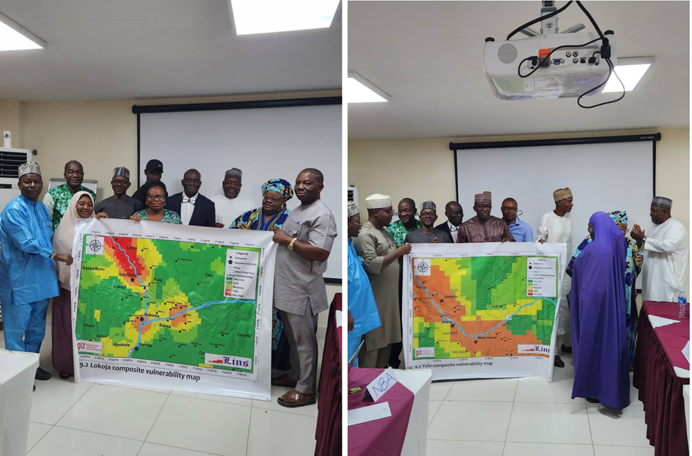
12. At the close of proceedings, participants validated the diagnostic study and the maps produced, subject to the incorporation of the observations recorded in the consolidated comments matrix.
13. LINS Consult Ltd will submit the revised report and maps by 6th December 2026. The NBA, the NFS of Nigeria and GIZ will review them, so that the final report can be delivered before the end of the consultancy contract.
Vote of Thanks
14. Participants expressed their gratitude to the Government of the Federal Republic of Nigeria for its warm hospitality and the facilities provided, and to the Government of the Federal Republic of Germany, through BMZ and GIZ, for its continued support to the NBA.
15. The closing ceremony was chaired by Mrs Angela Keyede.